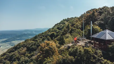
Climb to Grebengrad
Elevation profile
Move across the profile and the point follows on the map.
About the route
This popular hiking route starts in the village of Madžarevo. If you come by car, you can park by the school; the route is followed anticlockwise. The climb begins on a paved road up to a wayside cross, after which you enter a beautiful forest and climb all the way to your destination, the imposing fort of Grebengrad.
From Grebengrad you descend first on a gravel and partly paved road, then return to the embrace of the forest until you reach Madžarevo, where you can stop at the lovely Gradišće ethno village.
The route is not too demanding and also suits less experienced walkers with a lower level of fitness.
Along the route
Grebengrad, one of the largest medieval forts in this part of Croatia, first mentioned in 1209.
The mountain hut below the fort.
The Gradišće ethno village in Madžarevo.
When to go
Start & access
Start coordinates: 46.1690 N, 16.3062 E
Tips and safety
Follow the route anticlockwise. Always carry enough water, some food and spare clothing, and make sure your mobile phone is fully charged so you can contact the emergency services if needed.
An obstacle, damage or wrong data — email us, no sign-up needed.