
MTB BIKE PARK
Elevation profile
Move across the profile and the point follows on the map.
About the route
The hilly landscape linking Posedarje on Novigrad Sea with Vinjerac on the Velebit Channel is criss-crossed by countless tracks and paths. They once connected villages, hamlets and single houses; today they are a superb destination for walking, hiking and above all mountain biking.
The bike park is a network of interconnected gravel, stony, dirt and asphalt tracks. Riders choose their own direction and combination of tracks to suit the distance, fitness and technical skill they want, and on the way can visit the Way of the Cross in Posedarje or cool off in the sea on either shore.
Along the route
The Way of the Cross above Posedarje, with a unique view of Novigrad Sea and the surrounding landscape.
When to go
Start & access
Start coordinates: 44.2203 N, 15.4698 E
Tips and safety
This is a network of trails, not a single route: the track shows all the paths in the park, and you choose the direction and length of your ride. Trails vary in technical and physical difficulty, so plan your ride carefully, especially if you are less experienced.
An obstacle, damage or wrong data — email us, no sign-up needed.
More in Novigrad SeaSame activity first
All routes (7) →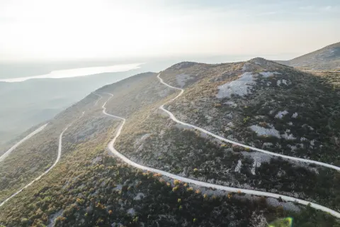 MTB
 Road
 Road
 Road