Bukovac
Elevation profile
Move across the profile and the point follows on the map.
About the route
This popular but physically demanding route takes you on an unforgettable journey through the beautiful landscape of Biokovo Nature Park. The Bukovac route is intended for recreational hikers, but it also offers enough challenges for the more experienced as it passes through authentic mountain landscapes.
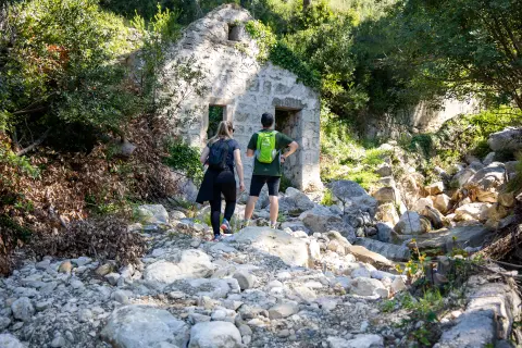
The route starts in Gornja Brela, near the Biokovo Nature Park presentation centre. From here, climb up to the Bukovac mountain hut, a popular resting place and meeting point for hikers. This first part of the trail passes along many drystone walls bordering the fields in the vicinity of Gornja Brela, and then continues through the forest all the way up to the Church of St. Nicholas.
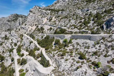
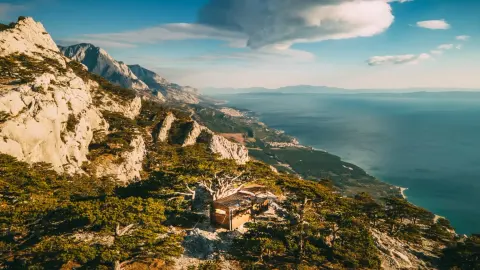
After the church, the route becomes somewhat more demanding, especially when the forest is replaced by a sloping terrain covered with loose stones, which requires greater caution. The route reaches its highest point on the plateau where the Bukovac mountain hut is located. Although not open all the time, the hut area offers a beautiful view and is ideal for rest and refreshment before returning.
The hike returns back to Gornja Brela via the same route. As you return along the path you have just conquered, you have the opportunity to enjoy the panoramic views and the beauty of Biokovo once again.
The Bukovac route is ideal for hikers looking for a challenge and adventure in the almost untouched mountain environment of Biokovo. Enjoy every step and discover the charms of this beautiful mountain landscape as you explore this unforgettable route.
Along the route
Bukovac mountain hut: One of the key points of the route is the Bukovac mountain hut, a popular place for hikers to rest and meet, with wonderful views of unspoilt nature and the sea.
Church of St Nicholas: After a harder climb through the forest you reach the Church of St Nicholas, an important symbol of the area and an ideal place to pause in the silence of nature.
Panoramic views: The whole route offers beautiful panoramic views of the surrounding mountains, valleys and the Adriatic Sea.
Dry-stone walls and enclosed fields: The first part of the trail passes dry-stone walls and enclosed fields around Gornja Brela, traditional elements of the landscape that give an insight into local culture and history.
When to go
Start & access
Start coordinates: 43.4097 N, 16.9155 E
Tips and safety
After the Church of St. Nicholas, the route becomes more demanding and more caution is needed, especially as you leave the forest and the route leads through sloping terrain over loose stones.
An obstacle, damage or wrong data — email us, no sign-up needed.