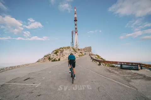
243 Destination Route
Elevation profile
Move across the profile and the point follows on the map.
About the route
This challenging, circular road route offers everything that "serious" cyclists seek: physical and technical challenges, as well as a long ride through beautiful roads with low traffic intensity amidst untouched nature. Spanning nearly 180 kilometers, it connects all the most beautiful features that the Makarska Riviera and Zabiokovlje have to offer, featuring notable ascents and plenty of natural attractions.
The best way to start the route is with a climb towards the entrance of the Nature Park, then continuing over the mountain towards Vrgorac and Polje Jezero. From Vrgorac, the route turns through the hilly karst landscape of Zabiokovlje towards Imotski, passing by the beautiful lakes - Blue, Red, Green, and Galipovac, after which it leads towards the coast, to Brela. The last twenty kilometers follow the coast and bring you back to the starting point.
If you decide to delve deeper into all parts of the destination, local culture, and gastronomy, you can also ride this route in three daily segments of around sixty kilometers each: from Makarska to Vrgorac, from Vrgorac to Imotski, and from Imotski back to Makarska.
Along the route
Near Imotski the route passes unique lakes – the Blue, Red and Green Lake.
The Prološko Blato viewpoint offers a beautiful view of the Imotsko polje.
The descent near Dubci opens up wonderful views of the Adriatic and the Makarska Riviera.
On the D512 state road, near the Stupica tunnel, there are two viewpoints overlooking the riviera.
The route passes the Kokorići ethno village.
The viewpoint on the Vina climb offers a lovely view of Polje Jezero, Croatia’s largest wine-growing area.
When to go
Start & access
Start coordinates: 43.2851 N, 17.0315 E
Tips and safety
You can find shops in Vrgorac, Imotski, Slivno, Runović and Zmijavci. Cafés and restaurants in Vrgorac, Imotski and Zmijavci are open all year round, in Slivno only in summer.
An obstacle, damage or wrong data — email us, no sign-up needed.