
242 Around Biokovo
Elevation profile
Move across the profile and the point follows on the map.
About the route
A classic, circular, and one hundred kilometers long road route encircles Biokovo, connecting coastal towns and inland areas with the expanses of the mountain, while also touching the peripheral parts of the nature park.
The route features several climbs and descents that are not overly challenging for experienced cyclists, providing unforgettable views of the Adriatic Sea and the karst beauty of Zabiokovlje. This is one of those almost obligatory "must-do" routes for every passionate cyclist visiting the Makarska Riviera.
Along the route
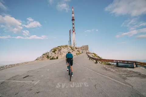
The Biokovo Mountain, one of the celebrated coastal Dalmatian mountains, is not just a geographical concept. Its monumental presence gives character and identity to the entire wider region on both sides of its peaks. Viewed from the sea, Biokovo rises almost vertically from the coastline to the dizzying height of 1762 meters above sea level, which is the elevation of its highest peak, Sveti Jure.
When to go
Start & access
Start coordinates: 43.2945 N, 17.0269 E
Tips and safety
The first twenty kilometers of the route follow the D8 state road, where extra caution is required. The traffic frequency is somewhat lower after the ascent towards Dubci and on the part of the route that passes through the hinterland of Biokovo. The route features two beautiful road ascents - the Turija tunnel and Kozica. As you descend from Gornji Igrane towards the Makarska Riviera, you can enjoy spectacular views and viewpoints of the islands of Brač and Hvar, as well as Pelješac. In Zagvozd, a "pit stop" to stock up on fluids is essential because there are no shops or catering facilities until you return to the coast.
An obstacle, damage or wrong data — email us, no sign-up needed.
More in Makarska Riviera, Biokovo and ZabiokovljeSame activity first
All routes (19) → Road
 Road
 Road
 Road